Unlock the power of creativity!

hand drawn south America map isolated on white background
south america on white background vector EPS10
Charleston, South Carolina, USA Historic Cityscape 384
Charleston, South Carolina, USA
America map set with states borders isolated on white. Grey coloured map set. Vector
Vector of South African flag
Set of South carolina map, united states of america. Flat concept symbol vector illustration
south carolina flag in state shape icon
south carolina map. logo vector.
Southern plantation in the fog
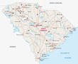
High detailed vector map - South Carolina.
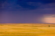
Rolling plains against a dark stormy sky in the Badlands, South Dakota
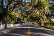
USA, South Carolina, Beaufort, Oak tree alley
Flag of South Carolina, Authentic version in color and scale
Aerial view of Capetown, SOuth Africa
South Carolina Map Black | State Border | United States | US America | Transparent Isolated | Variations
Gyeongbokgung palace with cherry blossom tree in spring time in seoul city of korea, south korea.
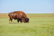
American bison Bison bison grazing in grassland of Badlands National Park, South Dakota, USA
USA, South Carolina. Hilton Head Island, sand dune, sea qat grass silhouetted at sunrise.
african man waving a south african flag
Beautiful landscape of a mountain cliff in south america
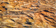
Dry arid landscape from central South Australia. Aerial images over the Painted Desert, Dry Creek Beds, and scrub bushland
Flag of South Africa silk
South America map isolated on a white background. Latin America background. Map of South America with regions. Vector illustration
Downtown Columbia South Carolina Skyline SC Aerial
Aerial photo of Cape Town
Antique roman bridge called ""Pont du Gard"" in the south of France
Rock hill south carolina downtown in the morning
Charleston, South Carolina, USA
Rocking rugged coastline in Western Australia's south west
Nelson Mandela Bridge over Johannesburg Park Station in Gauteng South Africa
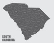
The South Carolina isolated map and its counties with labels
South Carolina state capitol building or Statehouse
Panorama silhouette Giraffe family and tree in africa with sunset.Tree silhouetted against a setting sun.Typical african sunset with acacia trees in Masai Mara, Kenya
carolina map logo vector.
South Carolina (USA) flag waving on the wind
Detailed world map with borders, countries
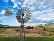
A metal windmill above a field and hilly area in south east Queensland
landscape of south carolina low country marsh at sunrise with clouday sky
South Africa on white background vector
Lovely park in Sioux City South Dakota
Panorama Route South Africa, Blyde river canyon with the three rondavels, impressive view of three rondavels and the Blyde river canyon in south Africa.
Large southern live oak (Quercus virginiana) near Charleston, South Carolina
South East Asia map with regions, countries. Indonesia, Vietnam, Thailand, Philippines, Malaysia maps. Outline South East Asia map isolated on white background. Vector illustration
Germany, Upper Bavaria, Alpine foreland, 'Das Blaue Land', Riegsee, south bank near Murnau
south africa map silhouette
greenville south carolina on reedy river in downtown
Charleston fountain from above
Columbia, South Carolina, USA
Myrtle Beach boardwalk South Carolina
The South Carolina isolated map and its counties
South Carolina State Flag Palm Tree Moon on transparent background
Vector illustration with map of North and South America continent with countries borders. Grey silhouettes, white background. White line borders of countries
South Carolina state outline contour silhouette map
African Safari Silhouette Banner