Unlock the power of creativity!

Graphic comparison of two stylized earth globe icons showing continents in outline and solid fill
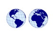
eastern and western hemispheres of the planet earth. globe icon
View of the Earth's western hemisphere at night showing illuminated connected cities from North to South America with bright lights and network lines against a dark space background
Vector illustration of Western and Eastern Hemispheres of planet Earth, silhouettes of continents. Eurasia, America, Africa, Australia, Antarctica
Infographic of the functions of each hemisphere of the brain. Left brain logical, analytical, right brain intuitive, creative.
World planet simple blue icon. Globe earth hemisphere combination vector symbol
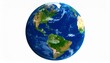
Blue and Gold Earth over white background - western hemisphere
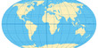
World map with most important circles of latitudes and longitudes, showing Equator, Greenwich meridian, Arctic and Antarctic Circle, Tropic of Cancer and Capricorn. English. Illustration. Vector.
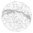
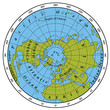
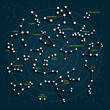
star map of the northern hemisphere of the earth
Earth Globe Isolated on White Background
Left and right hemisphere of human brain watercolor illustration
Melbourne railway station at night from the viewing platform in the Eureka Tower, the highest viewing platform in the Southern hemisphere, Victoria, Australia.
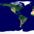
Western hemisphere texture. Satellite image of the Earth. High resolution texture of the planet with relief shading (land topography) and without atmosphere.
Outline silhouette hemisphere set isolated on white background
vector illustration set - map of the world, the two hemispheres
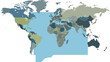
World Map Depicting Countries and Continents in Gray Tones.
Northern Hemisphere detailed illustration
The northern hemisphere of the earth. The northern hemisphere of the earth. Europe, Asia and Africa. Photo realistic 3D render. Photo realistic 3D render.
A black silhouette of the western hemisphere on a white background
World Map Highlighting Atlantic Ocean and Surrounding Continents.
A stylized Earth globe illustration showing continents and oceans, with latitude lines
High detailed sky maps vector set
World Map Showing All Countries Borders Political Geography.
Vector hemisphere with gradients and shadow for game, icon, package design, logo, mobile, ui, web, education. 3D hemisphere on white background. Geometric figures for your design.
Simplified map showcasing North and South America's continents.
Detailed illustration of the human brain viewed from lateral perspectives
Decorative hemisphere with black circles on a white background. Vector 3d graphics.Design elements for advertising flyer, brochure layout, presentation layout, brochure template, book cover. eps 10
Constellation map featuring orion and ursa major against a white background
World vector map with country boundaries and graticules (Western hemisphere, orthographic projection, PPT-compatible & fully editable)
Black and white illustration of a globe showing the western hemisphere Americas and part of Antarctica in white on a black background
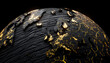
Black textured Earth globe focused on North and South America with glowing gold cracks. Concept of western economy and trade relations
Human brain vector concept
Northern Cyprus on the globe. Earth hemisphere centered at the location of the Turkish Republic of Northern Cyprus (TRNC). Northern Cyprus map.
Hemispheres of the planet earth, eastern and western
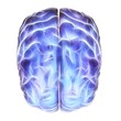
Electrical activity in the brain, artwork
Map of the Americas A Political and Geographic Overview with Continent Outlines
Night starry sky in the Northern hemisphere depicted in a 3D cartoon rendering featuring various cosmic bodies and constellations Small bright lights represent the stars against a space background
Sky map with 3D effect. Constellations. Stars.
Star constellations around the poles. Nothern and Southern high detailed star map with symbols and signs of zodiac. Black astrological celestial map
Northern hemisphere of our planet. Set of 3d renders shows Earth without atmosphere, only surface. Render with nice resolution- small details and terrain heights are present.
Human brain right and left hemisphere illustration. Creative concept vector design.
High detailed sky map of Northern hemisphere with names
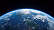
earth planet view from space. generative ai
Earth planet in outer space. Asia. Night side on planet with cities lights. Near and Middle East, Central, West, South, East Asia at night viewed from space.
What is Sphere and Hemisphere. What is latitude and longitude lines. vector illustration. earth image. southern pole, northern pole, eastern half and western Hemisphere. Space and earth science.
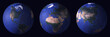
Four different views of the world globe in a row
“Continental Canvas: Earth’s Western Hemisphere in Full Relief”
World vector map with country boundaries and graticules (Eastern hemisphere with -20 degree offset, Guyou projection, PPT-compatible & fully editable)
Eastern Earth hemisphere with scale
gray world western hemisphere vector map detailed accurate illustration isolated
Vector illustration of Western Hemisphere of planet Earth, silhouettes of continents. North and South America, Antarctica
Sao Tome and Principe on the globe. Earth hemisphere centered at the location of the Democratic Republic of Sao Tome and Principe. Sao Tome and Principe map.
Arctic and antarctic poles globe hemispheres. World map view from space isolated on white
World map illustration showing continents and countries from a global viewpoint
3d white hemisphere podium modern elegant geometric shape decor element
earth day illustration. eco globe icon. western hemisphere of the planet earth. isolated vector image